Archive | Uncategorized RSS feed for this section

Life and Cycling

7 Dec

IMGP0060

Hi all

I am aware that it has been a while since my last post. When I first started up this blog in late 2012 I was college student with almost 4 days a week of spare time on my hands and very little to channel it into, since then I have become much more busy. Beginning with the founding of the Solihull Bicycle Campaign and the start of my university course in 2013, the launching of the SBiC monthly newsletter and my registration as a CTC Right to Ride rep earlier this year (resulting in me joining the Solihull Cycling Steering group earlier this month). All this together with a rapidly increasing university workload and various campaign and consultation meetings, has very quickly made me a busy person. Which brings me back to the blog, due to the time required to research and write posts for this blog it will regrettably be shifting to an as-and-when basis. I may down-shift to random small posts on a periodic basis but I still intend to complete the route review series.

All of this work seems to arrive and disappear in cycles, there will be times where I have to schedule my waking hours down to the half an hour just to get half of the things done that I need to, waking up at 5 am and getting my first down-time at 8 at night, 6 days a week. The are other weeks, especially during the summer, where it seems like I have all the time in the world to channel into the important things in my life. Thinking about these lows and highs, made me consider the other areas in which I experience similar changes.

As a cycle campaigner there are plenty: there are always those times when the council makes the right noises, support appears to be gathering or funding is announced and then you hit the brick wall. Comprising of government regulations, hamstrung funding, cycle behaviour filibusters and general lack of vision, consideration and forethought. Like when the government announces a ‘cycling revolution’ on the backs of a couple of million and then proposes billions of pounds for motoring in almost the same breath. Or when a visionary cycle scheme turns out to be nothing more than narrow shared-use pavements. Meaningful infrastructure is proposed, which is then either hamstrung or binned due to a few very vocal (or very rich) people. This is usually mirrored by cycles within cycling (excuse the pun). You get days where the sun shines, all drivers give you more than enough room, and cycling in the UK doesn’t seem like a bad thing it all, and then autumn hits and the grey drudgery and frustration of life in transportation limbo returns Faced by these constant cycles of depression it is no surprise that campaigners in the UK very quickly lose motivation and are ready to celebrate every advance no matter how small.

However it is also important not to forget what it is that we’re campaigning for. My drive is to make the world a better, happier and more sustainable place not just for me, but for my family and everyone else around me. And I will keep on working towards that ideal no matter what. So even if things look bleak remind yourself of your reasons,  ever lose hope that things can be better and don’t stop fighting just because someone tells you it’s impossible. Remember:
The night is darkest

So never give up!

North Solihull Route Reviews- Part 1

11 Sep

As the majority of the routes in the North of Solihull are part of the North Solihull Strategic Network, I thought it best to proceed with a comprehensive review of all routes in the north so as to provide a joined-up picture of cycling provision. To assess the routes effectively I looked at three central criteria:

  • Safety– Does it improve safety for all users? Does it have a good degree of social safety? Does it feel safe?
  • Continuity– Is the route part of a wider network? Does it provide a meaningful connection? Is priority preserved where possible to allow conservation of momentum? Is the infrastructure and level of protection consistent and intuitive?
  • Attractiveness– Will all ages and abilities of bicycle user use the facility? Does it provide a viable alternative to the car for most? Is the surfacing and design comfortable and usable? 

Safety- The majority of this route is completely off road and therefore offers complete separation from motor traffic. The shared use section at the beginning is wide enough to support both bicycle users and pedestrians, however the narrower sections of lightly separated path later on have the potential to cause bicycle-pedestrian conflict and reduce the safety of the pedestrians. While the route does travel through relatively quiet areas, the sight lines and path lighting is relatively good affording some measure of social safety (the exception being the bridge over the path near the end). With the exception of the one on-road section of the route, the route itself feels very safe.
Continuity- The route links Sheldon country park, and a back road route to Solihull center, to Chelmsley Wood center via well populated residential areas (including a new development). Providing a connection to the wider network of shared-use paths around the Chelmsley Wood center and therefore functioning effectively as part of a wider network. However the actual access to the center is very roundabout and lengthy. Besides the need to give way to slower pedestrians, momentum and continuity is pretty well preserved and the route is also relatively intuitive to follow.
Attractiveness- Besides the one on-road section mentioned, this route is definitely safe enough for those of all ages and abilities. The above mentioned problems with pedestrians and the rough surfacing in places could however reduce the route’s attractiveness as a faster cycling route. Overall the route is pretty attractive and provides a viable alternative to the car for trips to the parks and shopping centers. 

Suggestions for improvement:

  • Provide a more direct and level crossing of Bell Lane.
  • Resurface the service road leading from Bell Lane.
  • Provide a dedicated crossing point and off-road facilities to connect the route seamlessly at Gloucester Way.
  • Widen and more clearly delineate the lightly segregated paths after Gloucester Way.
  • Provide better sight lines and lighting for the underside of the bridges.
  • Provide a dedicated and direct cycle access path to the cycle racks outside the Asda complex (may need to provide more racks in near future due to increased demand).

Safety- Again the majority is shared-use paths of narrow width; safe for cyclists but not as much for pedestrians (particularly people with sight or hearing problems). Social safety is a mixed bag, the first section has appropriate sight lines and foot traffic with some lighting, however the section that passes through the alleyways and underpasses of the residential area lack these completely and as such have poor social safety. Route feels relatively safe, excepting the social safety of the alleyways.
Continuity- This route links Chelmsley Wood to the parks and the shared-use paths around the Woodlands campus of the Solihull College, linking key sections of the network. Besides the ever present issues around pedestrians the section of the route through the parks offers reasonable continuity and conservation of momentum, however the section through the residential area offers numerous barriers and winding turns while taking a less direct route to its end. The second section also lacks intuitive route follow.
Attractiveness- The off-road nature of the route makes it attractive to all ages and lower abilities, however the low social safety and lack of directness in the latter sections makes it undesirable to most users (particularly faster users) and does not provide a viable alternative to car use. Surfacing is fair, but could do with an upgrade.

Suggestions for improvement:

  • Possible improvement of the crossing of Chemsley Road through combined pedestrian and cyclists zebra crossing (if DFT approves designs).
  • Widen and more effectively delineate paint-segregated paths.
  • Clean, resurface and provide more effective lighting for underpass.
  • Provide alternative to latter section, possible rerouting section along the Chester Road via existing shared-use path with a direct off-road route along Birmingham Road to connect to Auckland Drive directly.

This one has been covered before, but in the interests of a comprehensive review I decided to do it again.

Safety- Mostly shared-use paths (see above routes), while the on-road sections involved in connecting to the Chester Road are relatively quiet bicycle users are still forced out onto the carriageway without protection. Social safety however is pretty good as sight lines are decent and route is well traveled. 
Continuity- This route provides access to a branch of the Solihull college as well as several schools, however it does lack effective connection routes to the rest of the cycle network. Continuity is extremely poor with the large number of side-roads and cul-de-sacs that the cycle route is required to give way to. Infrastructure is inconsistent in the latter sections as the distinction between shared-use and pedestrian-only pavement becomes blurred, as well as this the mixture of on and off-carriageway provision does not provide effective end-to-end travel.
Attractiveness-  The need to give way to both pedestrians and every minor road entrance, compromises the attractiveness of this route (except for those of low ability and very sedate pace). Therefore not providing a viable alternative to car trips. Surfacing is for the most part very pleasant and the off-road sections are relatively intuitive.

Suggestions for improvement:

  • Provide a direct and off-road connection to shared-use paths on the Chester road at both the south and north ends.
  • Preserve cycle path priority across minor roads and dead-ends. Possibly by creating a raised table and reducing the width of the road mouths by half (one car width) with clear markings indicating priority.


More route reviews to come in the near future, watch this space.
B

Mapping Sustainability

2 Jul

mind-map-for-the-future_31tjf199
At the core of the map are the goals or outcomes of an integrated approach to sustainable transport and urban planning, the three core values of health, prosperity and happiness are the by-products of leaving a better world for future and represent some of the core values of society.

Health- The sustainable approach has numerous health benefits: exercise fits more naturally into busy lives through active travel; motor traffic levels fall, reducing air pollution and traffic casualties; and public health funding is freed up for those who really need it.
Prosperity- Active transport methods are already essentially low cost and by bringing public transport fares down to a reasonable level, people with limited budgets can still travel effectively as those with cars do now. By freeing up disposable income and reducing transport poverty quality of life can increase.
Happiness- There are countless ways in which sustainable planning increases happiness including: increased community and childhood freedom, the de-stressing effects of exercise, reduction of wasted commuting time, and more money to spend on the things that matter.

The actual map itself is split, for the most part, into three different strands: Cycling and Walking which come under the heading of Liveable Streets, which encompasses any methods to make streets more friendly and safe for people to roam; and Public Transport which stands on its own outside the envelope. All of these seek to reduce motor traffic through the provision of alternative, and more sustainable, modes of transport. The basic argument is that each of these modes fill separate and necessary roles in transport, attracting different people with different needs and distances to travel.

Cycling
IMG_4006

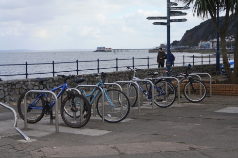
This strand is based on the premise that unprotected and vulnerable bicycle users should not occupy the same space as large/fast chunks of metal, and that a cycle network needs to be intuitive and safe enough to be used by all (from 8 to 80). To deliver the design criteria of a network of safe, convenient, attractive and continuous cycle routes a range of approaches are needed depending on the specific road by road situation.

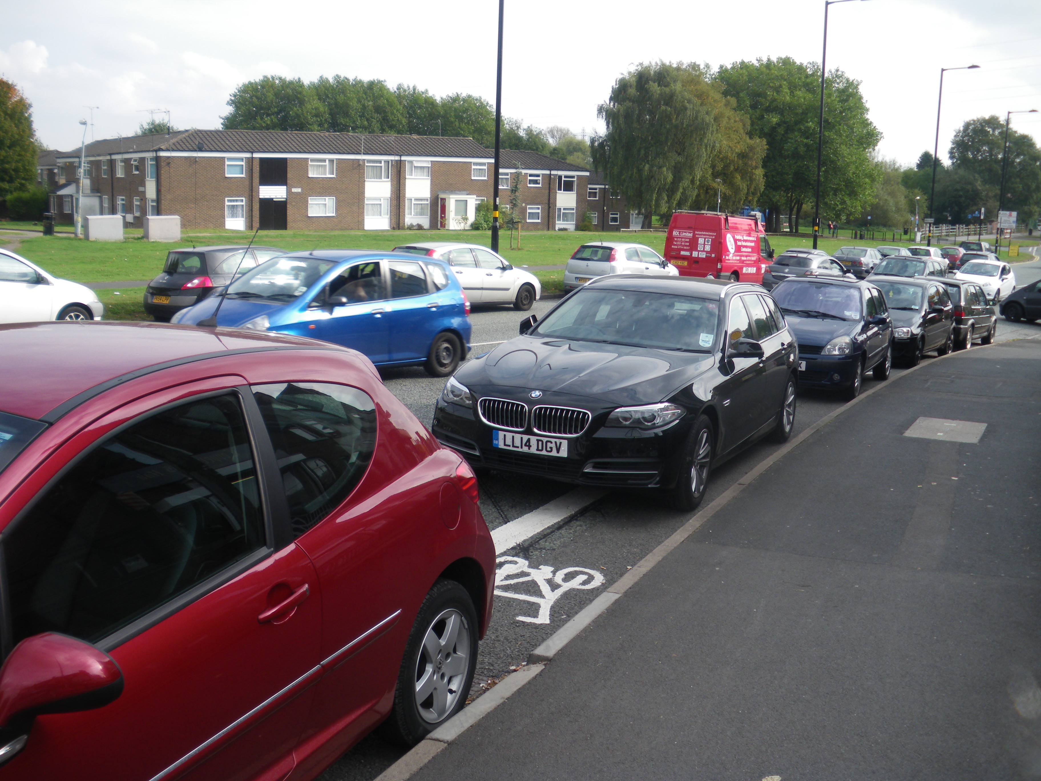
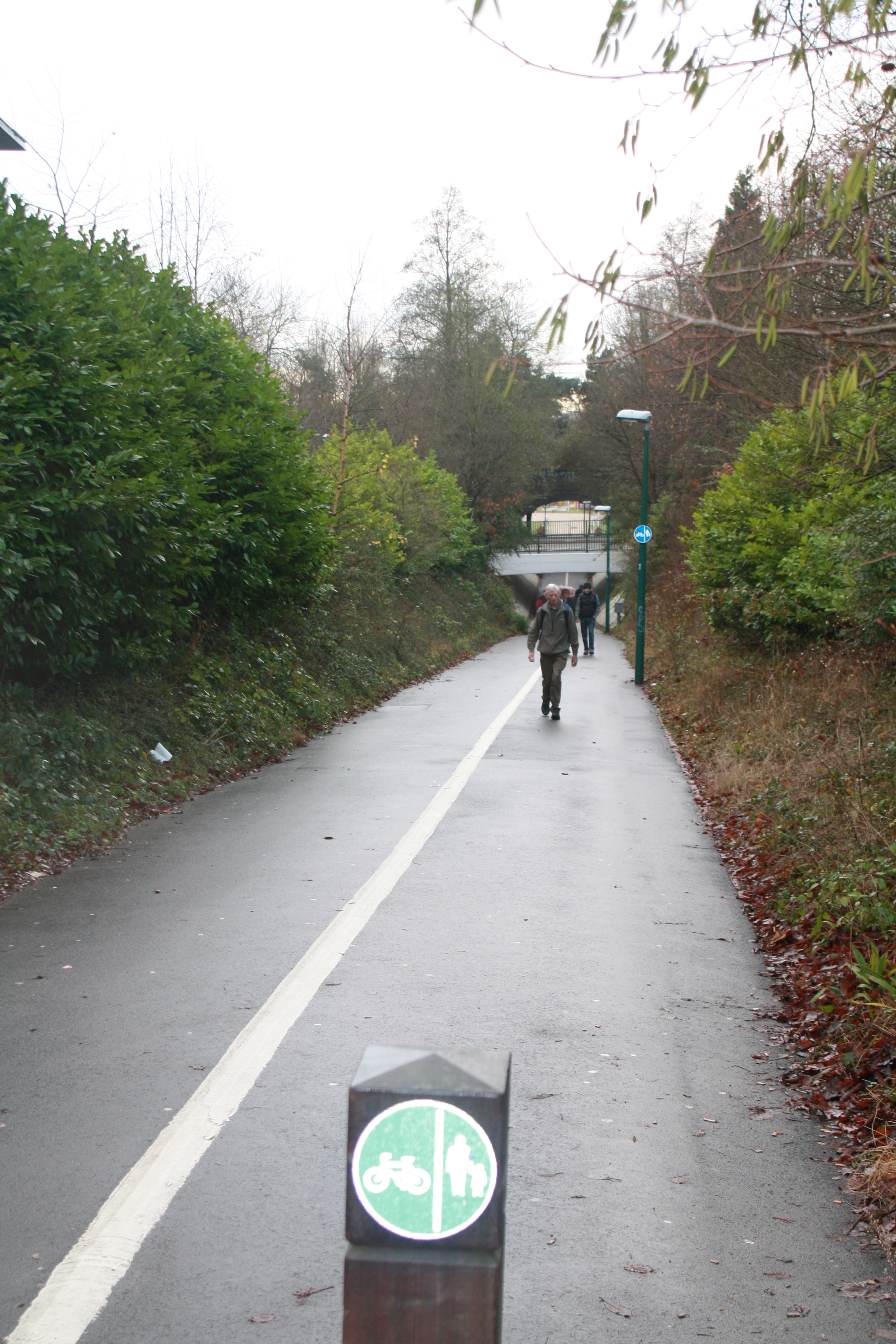
  • Protected bike lanes- Those on bicycles value direct and intuitive routes as much, if not more than, those in cars, such as those offered by main roads. Major roads can also offer a significant barrier to cycling, effectively driving near impassable rift in between neighbourhoods. Therefore for a cycling network to function, it is necessary to allocate protected road space to bicycle users.
  • Fully separated bike routes- In other areas where space is not at a premium it can be desirable to provide routes that are completely removed from those used by motor traffic. Such as running parallel to high speed trunk roads, providing connections through rural areas or to provide a more direct route for bicycles, such as through a park or green space.

There are also a number of approaches that have benefits for both bicycle users and pedestrians, and therefore falling squarely between the two strands:

20mph- By reducing traffic speeds general conditions and safety of active travel users is improved. Reducing to 20mph means drivers have reduced stopping distance, are able to achieve a greater awareness of surroundings and in the event of a collision the chances of fatality are greatly reduced. This can greatly increase the liveability of a street and at very low traffic volumes can allow bicycle users to mix with general traffic. While these zones should be seen as a minimum requirement in residential areas, there is scope for 20mph replacing 30mph as the default, requiring higher speed limits to be the exception rather than the rule.

Rat-running restricted- Otherwise known as filtered permeability this is the practice of restricting non-residential motor access while still providing a through route for active travel. This can be achieved through effective use of bollards, planters, kerbs and one-way systems (with bicycle contraflow). If used in conjunction with 20mph limits, the volume and speed of motor traffic can be greatly reduced creating a safe and welcoming streets for pedestrians, bicycle users and residents.

Legal protection- While this approach is very much junior to providing safe and welcoming environments (and should not be seen as an alternative to doing so), creating a system were anti-social and/or dangerous behaviour is dealt with appropriately can be seen as a necessity for a safe and effective transport network. To work effectively the system should be based on the logical presumption of; the greater the danger posed, the heavier the sentence. A car driver has the potential to substantially more harm than a pedestrian or bicycle users simply due to greater potential kinetic energy and therefore should be held to a higher standard of responsibility and receive a heavier sentence when failing to do so.

Open street events- These can be as big as Sky Rides and car-free Sundays or as small as single-street parties, but they all involve temporarily reclaiming an area of the road network for people (rather than cars). By demonstrating that a street can be more than just a thoroughfare for cars, open streets can be an effective tool in encouraging people to look at their streets and lifestyles in a different light. Giving people the safety and security to interact others, try out new ways of getting around and generally have fun.

Traffic law enforcement- An effective sentencing system has no benefit if those as to whom it would apply to, never make it to the courts. Policing should be based on the scale and danger posed by behaviour, and enforcement should reflect this.

Appropriate priority across side roads and junctions- An area that has always failed pedestrians and bicycle users in the past is in safe passage across and through roads and junctions. Often offering a choice between lengthy waits at controlled signals or taking chances with the traffic flow, giving way to everything with four wheels or more. Priority across minor roads when traveling along a major one is critical for effective bicycle travel, due to the need to conserve momentum, but pedestrians can also benefit from measures such as continuous pavements (a raised table at a road mouth that allows the pavement surface to continue across it) which reinforce the underused right to priority over turning traffic. Junctions also require appropriate priority and safe areas for pedestrians and bicycle users. With the majority of bicycle incidents happening at junctions and pedestrians often being forced to sprint across multiple lanes of traffic, it is crucial to design effective junctions for all users.

Walking
cycling 1 011

While the majority of the above approaches to design benefit pedestrians through either reduction of traffic speeds, volume or priority, there are also a few that benefit pedestrians in particular.

o   Pavement parking ban- Pavement parking is an issue that is prolific across the UK. By exploiting a loophole in the law which does not prevent parking on the pavement but rather acts to restrict the act of driving onto the pavement, drivers are able to wilfully infringe on the rights of pedestrians to have a secure and protected space (note: shared-use bicycle and pedestrian pavements also violate this right). This is particularly problematic when vehicles obstruct the majority of the pavement and force pedestrians, including wheelchair users, the elderly, children and the blind, into the road.

o   Pedestrian zones- By removing traffic completely and giving space to pedestrians on a permanent basis this approach provides a safe, secure and welcoming area to socialize, relax, shop, eat or play. This is particularly effective in areas of high pedestrian density, such as town centres and shopping streets.


Public Transport
cycling 1 018

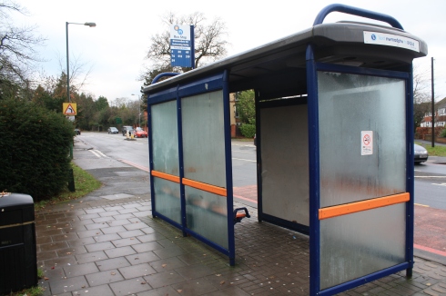
The third major strand covers public transport, this strand is based on the need for an effective method of traveling longer distances in between destinations, which is when active travel reduces in suitability. Public transport systems have the ability to move larger numbers of people more efficiently and sustainably than by motor car and, if ticket systems are reasonably priced, provide another solution for transport poverty.

While public transport as a whole could almost make up another entire mind map, this strand has been condensed into two key topics which can arguably deliver the greatest benefits.

  • Bus priority routes- Bus transport can provide more benefits than other similar transport types such as light rail/ metro as it is inherently flexible. As routes operate without tracks, a breakdown or fault in the route does not cause an insurmountable obstruction, capacity can easily be increased or decreased to take deal effectively with daily or annual fluctuations in demand, and the network itself is relatively cheap to set up. However there are some necessities involved in creating a bus network that is able to compete with other modes of transport. Main bus routes will have to un-coupled from the road transport network and given priority to allow them to operate efficiently and reliably, if bus routes are left to the mercy of rush hour traffic their desirability rapidly declines. Other areas that enhance bus networks are: having same level access to enter and exit, self-contained bus shelters with ticketing function, traffic light priority, and a central ticket system.
  • Fare and ticket standardisation- All too often an otherwise good public transport system suffers from complex ticket systems with a variety of largely expensive, and seemingly arbitrary prices, for different zones or distances. This has the overall effect of excluding a good proportion of potential users, it is therefore crucial that the ticket system is affordable, intuitive, easy to use and comprehensive.

o   Affordable- to be ‘public’ transport a system needs to be able serve a wide user demographic.

o   Intuitive- to be able to walk into an unfamiliar transport network and use it effectively is one of the hallmarks of a good system.

o   Easy to use- an example of this is London’s oyster card system, whereby you set up an account attached to your card and you are then able to pay for all public transport in the city by scanning your card at transport entry points, thereby eliminating the need to carry and source small change to pay for tickets.

o   Comprehensive- central ticket systems that allow you to change transport systems and travel between zones easily and without a change in ticket system, make public transport seamless, accessible and attractive to all.

Beautiful Neighbourhoods
47083_2433073363973_735138029_n

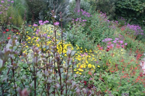
Standing outside the three key strands is ‘Beautifying’ streets. While not strictly a transport approach,this strand recognises that encouraging people to venture out and engage in a variety of transport forms and activities can be enhanced by enhancing the street environment an image. Typical approaches can include: bringing in more greenery such as trees and flowers, painting and refurbishing public spaces, creating green spaces and parks (a relatively new approach are ‘parklets’; small parks often the size, and replacement for a single parking space), providing areas that people can stop and relax in, and creating community art projects. Approaches like these can enhance social safety, draw together communities and encourage people to venture out in their neighbourhoods, however to be effective it is critical that all plans and projects are driven and by and engage the community.


Posted from sunny South Africa.
p.s. the cycling is awful around here.


A Solihull Cyclist in Wales

21 Apr

Recently, as part of my university course, I was able to spend some time in south Wales. Unfortunately I had to leave my bike behind; but that didn’t stop me from keeping an eye out for cycling stuff. Here are some of the pictures I took on my travels:

Our first port of call was Cardiff Bay; an area of significant regeneration and home to (among other things) the Welsh assembly building.
IMG_3855

As a whole there was little car traffic around; partly due to the restricted access along much of the bay. Barriers such as this rather neat bus gate:
IMG_3858

no doubt contributed to the decent number of cyclists using the bay-side roads. With a few exceptions, the Cardiff bay cycle trail extends pretty much continuously around the bay:

IMG_3867

One of the exceptions being the ubiquitous UK ‘cyclists dismount’ sign (now with added Welsh) for a wide pedestrian bridge:

IMG_3869

The Barrage lend itself to cycling through filtered permeability and low speed limits:

IMG_3892

Although Cardiff bay area appears to be emphasizing cycling as both a tourist attraction and an enhancement to its sustainability credentials pretty well, I do wonder whether better cycle connections with the rest of Cardiff are in the plans. Overall though I thoroughly enjoyed sightseeing around the area, by boat, land train and foot and I reckon I would have enjoyed a cycle around the bay even more.

After this we moved along the coast to the Gower peninsula and a small seaside town called the Mumbles:IMG_3922

While a very pleasant seaside town overall, the Mumbles (like so many other seaside locals) was blighted by motor traffic even during off-peak periods:

IMG_4005 IMG_4064

However effort has clearly been made to encourage walking and cycling along the seafront including; cycle parking:
IMG_4006

and refurbishment of the promenade:

IMG_3926

I saw a good deal of cyclists using this path; roughly divided into half  lycra and vis clad, and half wearing ordinary clothes. Here are some of the cyclists I saw while sitting on the seafront:

IMG_4007 IMG_4008 IMG_4009

The cycle path seemed like a pretty good way to enjoy the spring sunshine, as long as you don’t mind dodging the odd pedestrian. However I would hesitate before chancing the main roads surrounding the bay.

So if you’re looking for a nice holiday in Wales I would heartily recommend the stunning beauty of the Gower:
IMG_3934

(Iwould, however, think before travelling by bicycle).


Pollution: Enough is Enough.

2 Apr

http://www.theguardian.com/uk-news/2014/apr/02/smog-alert-england-wales-air-pollution-saharan-dust
Today (April 2nd) we were granted a vision of what an apocalyptic future might look like.

A thick pall of toxic smog hangs over the landscape, as enclosed capsules roar along barren streets belching out thick fumes. Those few that venture out into the polluted air are ridiculed, abused and endangered by the drivers of the speeding chunks of metal. 

While I may have taken some creative liberties with this account, it is not too far removed from the truth. A truth that might not be in the too-distant future.

So what caused this sudden pollution of British air? According to various newspaper articles, the cause is dust from the Sahara mixing with airborne pollutants from England and the North of Europe, creating a smog that blankets most of the UK and ranks in at a 10 on the air pollution scale (very high). Which in most cases mandates a health warning to children, asthmatics and the elderly to stay inside and everyone to avoid strenuous exercise. So just the result of some unusual weather, it’ll only crop up once in a while. right? Well actually no, air pollution is nothing new for the UK. The UK has been consistently exceeding the legal limits on air pollution since 2005, consistently refusing to take meaningful action to reduce air pollution.

This isn’t just some airy-fairy environmentalist thing, this is keeping the air safe to breathe for us, our families and everyone else in the country. These polluting particulates have been scientifically proven to be damaging to health and are directly linked to the deaths of over 4,000 people in London alone. So why is a pollution problem that is severe enough to breach legal limits for 9 years and mandate health warnings, not a national scandal?

The answer is that the average British person vehemently opposes and denies anything that requires a change of lifestyle or does not agree with their view of the world. Whether it is climate change, peak oil or pollution, any attempt to coax them  out of their air-conditioned bubbles is met with violent opposition. This is reflected by the policies of those in power: who stubbornly refuse to admit that there is a problem,  sidestep the issue, vastly exaggerate plans and progress, before quietly doing nothing.

It’s time for the UK to collectively wake up and smell the nitrogen oxide; air pollution is not going to magically disappear, get better or stay a problem only for the distant future. It is real, pervasive and its effects are already being felt, the time for empty platitudes and meaningless gestures is past. This is no longer a problem of ‘climate change’ and ‘being green’, it is something that if left unchecked will affect not only us, but the very lives and freedoms of out children.

Now if only there was a pollution free alternative to the motor car…


Rethinking Birmingham’s Dual Carriageways

14 Mar

Around the South and South-west of Birmingham particularly, there are a number of dual carriageways that follow a very similar layout. As I haven’t been out with a tape measure, rough estimates where the best I could manage. But here is a rough guide:

Image

As an urbanist (albeit amateur) this road represents, at a basic level, an inefficient use of space. However there are bigger issues to be found while travelling along these roads. (Dual carriageway section starts at 3:37)

As you can see in the video the left-hand lane is occupied sporadically by parked cars: not enough to close down the lane completely, but enough to make it a real pain to use. Cyclists and drivers moving at 30 mph or less (I also drive along these routes, at the speed limit) will generally find themselves forced into one of 3 options:

  1. Dodge in and out of left lane when gaps in the traffic and parked cars allow, which is both time and energy consuming.
  2. Cycle along the median line, putting up with close passes on your right and the possibility of being doored on your left (cyclists only).
  3. Take the lane and put up with the resulting impatience and aggression from following drivers.

This makes it a pretty much a damned if you do, damned if you don’t issue. Labelling and setting these roads out as dual-carriageways does not in fact provide any benefits. The random nature of the on street parking makes diminishes the predictability of the road and merely creates confusion and conflict. As well as this the dual-carriageway approach does not actually increase traffic flow, as combination of cars acting as pinch points and the eventual downgrading to one lane causes traffic to bunch up at points.

Therefore I two proposals for possible solutions to the space. The first is to narrow the grass verges and left hand lane slightly (converting it to parking bays), while at the same time moving the now dedicated parking lane to the right to make space for a protected bike lane along the inside of the parking bays.

bham-dual-carriageway-remix1

The second is to remove the left lane entirely and replace it with a  protected bike lane, while at the same time allowing parking on the section of the resident’s driveways that is parallel to the grassy verge.

bham-dual-carriageway-remix2

Both designs remove a unused traffic lane, make little or no difference to car parking (note: the majority of houses along these routes also include spacious driveways, provide protected space for vulnerable users, reduce pedestrian crossing distances and increase the traffic flow of the roads. One of the most prominent arguments that council planners have against bicycle infrastructure is the lack of space on the roads, which is quite clearly not an issue in these areas. Designing infrastructure onto roads such as these could be seen as a quick and relatively painless win, in getting decent cycle infrastructure in on the ground.

Solihull Cycling Strategy Review

3 Feb

In this post I intend to provide an analysis of Solihull Council’s Cycling Strategy document (2009). Note: All emphasis and opinion is my own. The overall goal of the cycling strategy is:

“To promote and increase cycle use throughout Solihull, by highlighting the benefits of cycling as a healthy sustainable mode of transport and through the development of green infrastructure which is safe, convenient, efficient and attractive for cyclists.”

While the idea of high quality infrastructure which is safe and attractive for cyclists is a promising one, the emphasis on promoting cycling is slightly worrying. Historically the government has placed significant emphasis on ‘encouragement’ versus decent infrastructure, however this has resulted in a pitiful 2% of all journeys by bicycle: promotion is clearly not the answer. Further on in the document it is stated that travelling to school by bicycle is the most popular choice among school children, and the main reason why they are restricted in this choice is road safety concerns. No amount of promotion can change this justifiable apprehension of road conditions.

Themes in the document:

“To publicise the health benefits and facilitate a cycling culture.”

I have similar concerns for publicising, as promoting. As for facilitating a culture; cultures grow from environments. If the environment makes cycling a safe and attractive option, then cycling culture will naturally follow.

“To make the cycling network more accessible by encouraging the development of neighbourhoods which are easy and attractive to use.”

A little vague on the details, but safer neighbourhoods through traffic calming, low limits and selective access are essential to a widespread cycling network.

“To ensure safer routes for play and better access to play spaces for children.”

This links in with the safer neighbourhoods above. However much of the newly installed infrastructure in the north of Solihull, is not the most child friendly. Putting the onus on the children to cross road mouths safely without assistance, as opposed to placing it on turning and emerging traffic. Image “It is proposed that the ongoing programme be adopted to create safe cycling facilities in Solihull’s parks and green open spaces and that greater use be made of the extensive existing networks of footpaths through conversion to shared use.” As I have covered in a previous post, this is a terrible, terrible idea. If there is any wish at all to raise cycle above the pitiful level that is currently experienced in Solihull, then shared use pavements should be avoided at all cost. Shared use pavements:

  • Become effectively single use as soon as foot traffic increases. Such as during school opening and closing times.
  • Do not provide priority across side roads, leading to turning conflicts and energy costly delays.
  • Can often be obstructed by parked cars.
  • Provide an unfriendly environment for pedestrians, especially those who are elderly or impaired.
  • Restrict speeds of bicycle users significantly, thereby making them very unattractive.
  • Are often cluttered with street furniture.
  • Are seldom maintained to the same standards as adjacent road sections, especially in winter.

Shared use pavements are therefore not; efficient (stop-start cycling), safe (not safe for pedestrians) and attractive (obstructions) and fail to meet the council’s own vision and aims, failing to separate transport modes effectively is a hallmark of an excessively car-centric authority and represents a failure to design for cycling. As well as failing the overall vision; “To promote cycling as a viable transport choice.” Infrastructure

“To make the physical cycling network more accessible and safer to all through the removal of barriers and coordinating and prioritizing works programmes.”

Not sure if this refers to barriers such as large roads and heavy traffic or actual barriers. Such as these that are found on the shared use route between Solihull College and Chelmsley Wood center: Image The former is obviously significantly better to deal with than the latter, however both are worthwhile aims.

“Cycling will be considered in the design of all new highway schemes.”

Still a long ways off requiring decent cycle infrastructure in new projects, or ensuring highway schemes do not actively make conditions worse for cycling: very much an empty promise.

“The provision of cycling specific facilities will consider the hierarchy of users and provision. This process will include a design review audit of all capital programme schemes from a pedestrian and cyclist viewpoint.”

From (Cycle Infrastructure Design, DfT, 2008) Via: CTC http://www.ctc.org.uk/article/campaign-article/hierarchy-provision As the provision states, shared use pavements should be considered last’, so Solihull Council appears to contradict itself directly. However the word ‘consider’ once again seems to be used as a get-out clause. I would be interested to know how heavily the council ‘considered’ the installation of shared use pavements.

“Specific attention will be given to the problems caused for cyclists by roundabouts and the creation of 20 mph zones around schools and residential areas.”

I fail to see what problems could be caused for cyclists by the creation of 20 mph zones around areas where they are most needed. Though I imagine it they are something to do with drivers not being able to overtake as readily, however that is a separate issue of impatient and inconsiderate driving. As for roundabouts, the target is most welcome. However I very much that interventions are not done to this poor and ill-considered standard:

Regional Policy- Local Transport Plan

“Vision for sub-region is a ‘vibrant thriving community where everyone will be able to have a better quality of life that is not dependent on the availability of a car.”

Excellent passage from a relevant document underlining the central argument for widespread and high quality cycle infrastructure.

“Cycling would be common place in an environment where people make direct, attractive, safe and comfortable journeys by bicycle.”

Applause! Would be great if infrastructure reflected this aim.

“Currently the level of cycling in the West Midlands is below the national average […] many journeys within Solihull are only a few miles in length […] Surveys report indicated that 46% of respondents would cycle more if infrastructure conditions were improved.”

Indicators of latent demand and the reason for this suppression in one paragraph.

Conclusion

As of writing this review I have been unable to locate the cycling or transport action plans, without which this document is very weak. So while the vision for Solihull’s future laid out in the strategy is a good one, the implementation is extremely weak on the details and very few meaningful commitments. However far more worrying is the continued emphasis on the conversion of footpaths, which is likely to continue setting back cycling progress for years to come.

Solihull Gateway Project

31 Jan

The Solihull Gateway project aims to expand the pedestrian realm along Station Road in the Solihull center. As there are a few concerns that I had over it, I took a trip down to Solihull Library to attend the consultation event. Here are my thoughts and the responses given.

UntitledSource: http://www.solihull.gov.uk/Attachments/Theme3_P.pdf

Central to the project (literally) is the shared space ‘courtesy crossing’, that will replace the existing light controlled crossing. The idea being that buses will give way to pedestrian traffic crossing the central area and therefore reduce motor vehicle dominance, however there are some potential issues. My concerns are that either pedestrians dominate the central area and require buses to ‘nudge’ their way through the crowds to make headway, or (more likely) pedestrians will see the central area as a road and give way to buses. Therefore creating an even worse crossing situation than before (after all, how many people would be willing to assert their right to the space in the face of a couple of tons of metal). A similar situation has occurred in a similar project in London: Exhibition Road.
The responses to the issues that I raised were along the lines of:

  • Bus companies and drivers will be briefed on the need to give way appropriately.
  • Bus services will potentially be increased to the area.
  • Slow speeds will enable mixing.

However I still have my doubts over the use of shared space, for one thing the edge of the central section of the shared space, despite being the same type of paving as the pavement area, is clearly marked as separate. This reinforces the central space as being a section of ‘road’ and therefore the dominion of motorised traffic, however if the edge strips were removed it would encourage the section to be viewed as an extension of the pavement. Therefore encouraging pedestrians to view it as their space.

Another potential issue is cyclist access to the area. This is the current layout:

Once you get to the end of the pavement path, there is a toucan crossing that allows you to either join the traffic flow and cycle in between the buses to the touchwood stands. Or cross onto the pavement and wheel your bike to one of the stands. The new layout looks something like this:

Gateway 2

Cyclists are supposed to either use both pedestrian crossings, by turning right onto a the narrow corner strip and then left across with the pedestrians again. Or alternately, attempt to cross three lanes of un-signalised traffic and then either scoot onto the pavement or join the traffic flow. The stands at the beginning of the high street will again only be accessible by wheeling your bike along the pavement or joining the bus flow.
Responses:

  • ‘Confident cyclists’ will be able to cut the corner.
  • Nothing can be done about the amount of space on the shared use corner, due to the church grounds.
  • There is a likelihood of the junction with Herbert Road becoming severely congested and blocked when queues to enter the John Lewis parking are at their worst (e.g. during festive periods)
  • There is the possibility of converting the pavement next to the bus stops to shared use if cyclists increase in number. (No proper response to my concern that increasing numbers of cyclists and pedestrians don’t mix).
  • There was a plan to put cycle infrastructure down the middle of the bus area, but due to the complications and safety issues, it didn’t make the final plans.
  • Official response is that as cyclists only make up 2% of all traffic (about 4 an hour apparently), they cannot be appropriately planned for.

However there are quite a few positive points to the scheme:

Gateway 3

  • In many areas of the project the crossing distances have been decreased significantly.
  • Relocating the taxi ranks and service road exit should reduce traffic through the bus/pedestrian area.
  • Increased pedestrian space, plaza style.
  • Tidier bus area which should reduce delays and conflicts.
  • Removal of traffic signals at the Herbert Road end should also promote bus efficiency.
  • Re-arranging of the bus stops creates more space and opens up the pavement just where it is needed.
  • Trees are always nice.
  • Increase of the 20 mph zone, always a good thing.

If the concerns that I have over this scheme are ironed out, this project looks like a pretty good step forward.

Freedom and Rights?

4 Jan

NHS could be ‘overwhelmed’ by people with long-term medical conditions: http://www.theguardian.com/society/2014/jan/03/nhs-overwhelmed-long-term-medical-conditions

One of the big accusations commonly leveled at cyclists, is that we are ‘elitist’ and have a ‘holier-than-thou attitude. Simply because we happen to live healthy active lives and not kill people or pollute the air we breathe in a bid to get around. The majority of politicians and decision makers do not appear to see these benefits and instead obsess about the votes they would lose, and the ‘right’ to drive. The UK is a country that prides itself on freedom and personal rights (as any sensible country should), but where should these rights and freedoms end? Should they be curbed when they infringe on other peoples rights? In a way they already do, there are laws in place that, for example, say that you do not have a right to shoot a shotgun in public, as this would infringe on the right of other people to live. So in this (rather extreme) example, behaviour is restricted according to the potential damage it can do to the rest of society.

However this system seems to fall to pieces as soon as it encounters the motor vehicle. Whereby those who drive are not only allowed to continue doing so despite the damage to society, but are also actively subsidized by the government.  So in this way, those who choose to cycle or walk are subsidizing the very group that pollutes the air, destroys the roads, damages the earth and endangers this very same group that subsidizes them. Many people at this point would say “So what? I enjoy cycling, they enjoy driving. Does it really matter where the money goes?” My answer to this is: what if that money spent on drivers could be used elsewhere? What if it wasn’t just about roads versus cycle tracks? What if that subsidy is depriving your children of the best education they could get? Or raising your council tax? Or maybe even encouraging lifestyles that are such a drain on the health system that it may not be able to function properly in the future! 

Maybe it is time for us to put on our ‘elitist’ and ‘holier-than-thou’ hats, and say to the politicians “We subsidize your freedom to drive that over-sized car. We represent a healthier and happier future for this country. Start paying attention to what we want and need, to keep doing the good we do.” This isn’t about proportional representation, according to amount of population that travel by a certain mode. But about supporting what people need and not necessarily what they want (at this point in time anyway), and supporting lifestyles that are good for the country as a whole.

Draft plan for the Solihull Strategic Cycle Network

22 Dec

Solihull Strategic Cycle Network Draft
(my proposal for a cycle network)

Image

The Solihull Strategic Cycle Network (SCN) intends to deliver a series of safe, direct, continuous and high quality cycle routes, connecting all of the major business, retail, leisure, education and population centres of the borough. Thereby enabling cycling as a viable alternative to motor transport; relieving pressure on the road network, increasing physical activity levels and improving the sustainability of the transport network as a whole.

Design Criteria:

  • Routes to be physically separated from both pedestrians and motor traffic.
  • Priority to be preserved past driveways and minor roads.
  • High quality surfacing and track width to be considered a priority (45 degree kerbs can help increase usable width). Paths to be wide enough to allow overtaking.
  • Safe, Dutch style design to be used to design out conflict areas and provide safe routes through junctions.
  • Routes will need to be maintained with regularity to provide a safe surface that is free of ice and debris (leaves, branches, broken glass, etc…).
  • Enforcement will need to be in place to prevent obstructions that endanger bicycle users, such as parked vehicles and building skips.
  • Routes through parks need to be well lit to provide social safety, and paths will have to be clearly marked through paint and/or physical separation to prevent pedestrian-cyclist conflict.

SCN1– Sears Retail Park → Solihull College Woodlands Campus.

Flagship route: route to run through the centre of the borough connecting the south to the north through a safe, high quality, and direct cycle route. The route connects many major leisure and business centres. Including: Sears retail park, Solihull College (Blossomfield Campus), Tudor Grange Park and leisure centre, Solihull Town Centre, Solihull Hospital, Jaguar Landrover Factory, Hobs Moat shops, Sheldon Park, Marston Green Station, Chelmsley Wood Centre and Solihull College (Woodlands Campus).

Route

  • Full segregation along Blossomfield Road, may require the removal of centre turning lane.
  • At the end of Blossomfield Road, bicycle track to be diverted around the outside of the roundabout with dedicated crossings. Emphasis on low wait times and single stage crossings; separated from both pedestrians and motorists.
  • Fully segregated track to be provided through Station Road to minimize conflict with the large numbers of buses in the area.
  • Route crosses the Warwick road using dedicated signals and runs down service road before joining Lode Lane near the hospital (therefore eliminating the major roundabout from the route).
  • Questionable area for cycle provision as ambulance access needs to be preserved; possibly divert track through hospital car park?
  • Cycle track to then continue along Lode Lane, making use of service roads where possible. Filtered permeability and 20mph limits should be installed to lower motorised traffic levels.
  • Section along Sheaf Lane and Sheldon park requires co-operation from Birmingham City Council.
  • Park and stream-side paths to either be enlarged and clearly marked with paint, or completely separated from pedestrian path.
  • Removal of barriers on cycle path north of Chelmsley Wood centre. However route may need to be diverted along Chester road to provide greater social safety.
  • Route to end at Solihull College: linking up with the shared use paths on Auckland drive.

SCN2– Chester Road → Bradford Road.

Route to run along the Chester Road; providing a key connection to SCN1, as well as serving the local shops along the route. Possibility of a connecting route to the Fort and Star City retail parks; by Birmingham City Council.

Route

  • Route to follow the Bradford Road, due to space requirements.

SCN3- Monkspath → Solihull.

Monkspath as a whole offers few attractive and cycle friendly routes. The majority of the area is made up of cul-de-sac s and dead-ends linked to fast flowing and busy main roads. By focusing on upgrading the existing route along Monkspath Hall Road, a sizeable portion of Monkspath can be linked to the Solihull Town Centre and SCN1 (as well as providing access to Hillfield Park).

Route

  • Upgrade of existing paths to more clearly separate pedestrians from cyclists and provide more appropriate priority through junctions and across minor roads.
  • Route to be diverted through Tudor Grange Park with similar pedestrian-cyclist separation.
  • Crossing of Homer road to be upgraded to provide better segregation and space for increased volume of cyclists.

SCN4– Knowle → Solihull.

An upgrade of existing cycle route, to provide access to both the Solihull and Knowle centres.

Route

  • Route to begin just outside Knowle centre (possible location for sheltered bicycle parking), due to space constraints along the high street.
  • Upgrading of route towards the motorway; in line with the rest of the SCN network.
  • Bridge over the motorway is the weak link in the route. Increasing the length and radius of the spiral (to provide a more gradual incline which can then be cycled up) and raising the height of the rails, should be considered as a minimum measure. With the possibility of a separate bridge/ widening of existing bridge as a long-term measure.
  • On road cycle lanes may be provided along the Warwick Road section, as traffic density is very low.
  • Park paths to either be enlarged and clearly marked with paint, or completely separated from pedestrian path to prevent conflict.
  • Removal of one traffic lane and installation of a one way system with bi-directional cycle paths, required due to space constraints.
  • Due to high pedestrian levels on the high street itself, the connection to SCN1 must be, by necessity, disconnected through this section.

SCN5– Monkspath → Shirley Shops.

Provides a safe and continuous route along the Stratford road, running from Monkspath to the Shirley high street and linking up with StrN1 at the Sears Retail Park. Also running via the Green Business Park. Extension of the route by Birmingham City Council, could provide a cycle route into the city centre.

Route

  • Route to be completely off carriageway, clearly separated from pedestrian areas and with appropriate priority across side roads and junctions.